Your Legal Resource
Cloud Seas - Sw Chutes Of Mt. Adams Wa
This site started off as a one-stop weather page for my own neurotic checks of the weather and conditions. I've continued to add comments and photos from ski trips in the Cascades (mostly Mt. Hood - my own backyard) and some points further afield - a way to recall past trips and jones for the next one... The Pacific Northwest possesses a lifetime of opportunities, and there are many others with whom I share a passion for backcountry skiing and inspiring views. A quick web search will easily link you to trip reports or resources that either inspired me to go to these places or inspire me to return.
---------------------------------------------------------------------------------------------------------------------------------
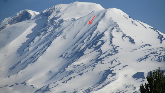
The chute descends between a large rocky spur to the south and a prominent gravely ridge to the north. At around 7,800 the chute widens out into a large bowl, bounded to the west by a large moraine. Here the route sweeps more to the south. At around 7,000 the route sweeps around the lower end of the rocky spur to the south. At this point many choose to exit the descent, traversing around the mountain to intersect the south climb route. If it's a killer day, you may choose to take advantage of another 800 feet of descent and continue downhill past the tree line. At around 6,100 feet the descent intersects with the round-the-mountain trail. Be alert, as it is not marked, and in deep snow, it may be completely covered. Follow this trail, staying high if it's covered, for approximately 2 miles until it intersects the South Climb route.